When you click on links to various merchants on this site and make a purchase, this can result in this site earning a commission. Affiliate programs and affiliations include, but are not limited to, the eBay Partner Network.
I have friends and business in Atlanta GA, so I find myself driving between Nashville/Atlanta 3, 4, 5 times a year. If you have the time, there are some seriously fun roads in North Georgia/SE TN/NW Alabama that you can use to bypass Chattanooga. About 2/3rds of it is nice, smooth, 2 lane, flat 55mph. If you need to make up time, you can easily drive 60-70mph, lots of room to pass. Since I usually have more time once I'm heading home from Atlanta, I usually take the scenic route.
On I75 north, you get off at the "Resca" exit, GA Route 136. Man that's a fun road, rural, slighly curvy, fast sweepers, you go over two big hills before you hit LaFayette GA. Take the bypass, get back on 136 west, Then you go up Lookout Mountain, steep grade, great views, a few switch backs. Then you pass Cloudland Canyon State Park, drop dead awesome views if you stop there, good hiking trails as well, good place to kill an afternoon hiking a few miles. Anyways, then you go down Lookout Mountain on 136, pretty damn steep, 3 or 4 switch backs, into Trenton GA. Interesting note, this part of GA is completely geographically isolated from the rest of GA, being on the far side of Lookout Mountain, I think rt 136 up Lookout Mountain is the only road you can take out of Trenton goes to GA, ie it doesn't lead to TN or AL.
Once you pass through Trenton, you stay on GA 136, and go up Sand Mountain, once again, several switchbacks. GA 136 turns into AL 71 once you cross the state line. This whole time you are on the plateau of Sand Mountain, its flat. AL 71 dead ends into AL 73, turn right. AL 73 eventually goes down Sand Mountain, and is one hell of a steep grade, it dead ends at a stop sign in TN at some rail-road tracks that run parallel to Lake Nikajack(aka the Tennessee River). I've seen a semi truck that lost its brakes at the base of the mountain, right where that stop sign is at, it ran the intersection and ran over the rail road tracks, got stuck about 3-4 feet from hitting the water. You can also turn off at AL 93, which is little more than a goat path going down Sand Mountain and into the valley. I've been that way before, its one hell of a road, maybe a top speed of 25-30mph, god help you if two dually trucks came in opposing directions, the road isn't wide enough.
Once you are in Tennessee, right along the TN river, you turn left onto TN 156, head towards the little town of South Pittsburg, once there you cross a bridge over the Tennessee River. At this point you can now turn right back to I24, or go left for more crazy roads. Turn left into downtown S Pittsburg, turn right on 2nd/TN 156, aka the side of the road facing a huge mountain. Then you go straight up again, several switchbacks, couple thousand feet in elevation to the Cumberland Plateau. Once the road levels out, its straight, narrow, and smooth for about 30 miles Very few cars on the road, double yellow line, hardly any side roads that cut in, almost zero driveways, you go through a state forrest. Speed limit is 55, I've driven 80, 90 mph+ on this stretch.
Then you get to Sewannee TN, notable for the University of the South and nothing else. Turn right on 41A and follow the road into Mont Eagle TN. To go the fun way, drive past I24 and take a quick left for the old road(US 41) down the mountain, its steep, twisty, well paved and a riot, the speed limit is 35-40mph, I dare you to try anything faster than 45. Once you are off the mountain, turn left on TN 50, back to I24, continue your boring drive back to Nashville for the next 70-80 miles or so.
This is the fun way to get from Atlanta to Nashville, or vice-verca, if you have an extra hour and a half, maybe 2 hours if you drive slow it is just a gloriously curvy and scenic route. The country through there is some of the best in the Eastern United States.
Arizona state highway 89A through Jerome. Narrow, switchbacks , and no shoulder in most parts of it. An elevation of over nine thousand feet. Then add driving a three ton Land Rover Lr3 with Johnson lift rods on it. It was about sixteen miles of it. It reminded me of driving in a mountain town in Italy. I thought it was a beautiful, my wife was so ready to get off that stretch of road.
. . .The most fun and technical road to date has to be the Pacific Coast Highway from around Monterey through Big Sur or thereabouts. Once you're on it you're locked in for a while until another turnoff that leads to the I-5 shows up. You want plenty of gas in the tank and after dusk you NEED an offline GPS unit in order to see the direction of the next curve in the road due to the thick coastal fog that sets in. Having a friend in the passenger seat to note the angle of the next curve to you is also a good idea. You really cannot see more than a few feet in front of your headlights when the fog is aggressive. Additionally, if your car came with dim headlights from the factory, an HID upgrade and fog lamps are recommended.
So CA SR 1 on the west coast is called PCH in the LA area but between San Francisco and San Luis Obispo, it is called the Cabrillo Highway after Juan Rodr�guez Cabrillo, a navigator and explorer, the first European explorer to navigate the coast of present-day California. North of San Francisco, it is just called the Shoreline Highway.
South of Monterey (basically beyond Carmel Valley Road), the next major connection to the highway is 90 miles down the coast near new Cambria, where SR 46 reaches the coast. SR 46 goes east to US 101 at Paso Robles in the southern Salinas Valley. Between SR 46 and Carmel Valley road is one, slow winding access road to SR 1 at the coast called Nacimiento-Fergusson Road. This road comes west to the coast from Fort Hunter Leggitt which itself is in the middle of nowhere but can be reached by a couple of roads from US 101. Nacimiento-Fergusson Road is a great trip itself winding through the forests and hills and then down switch back roads overlocking the coast.
But you can't go there now.
Right now, and for the next year or so, two major sections of SR 1 are closed, one just south of Big Sur and the other between Nacimiento-Fergusson Road and SR 46. So you cannot go. Nacimiento-Fergusson Road provides the only access currently to the part of SR 1 that is isolated between the two closures and I think N-F Road is only open to locals for now. These closures were caused by mudslides and the fact that bridges and parts of the road went missing into the ocean after this last, record-breaking winter rainy season in CA.
So do not attempt the trip up the Cabrillo Highway (south of Monterey) without checking for road closures. North of Monterey all the way up the coast, SR 1 is open and the whole trip provides fantastic scenery.
Hwy 1 south of Monterey does provide stunning scenery, but generally (even now when closed south of Big Sur) is clogged with slow moving tourists. So don't expect fast driving - by fast, I mean the posted speed limit.
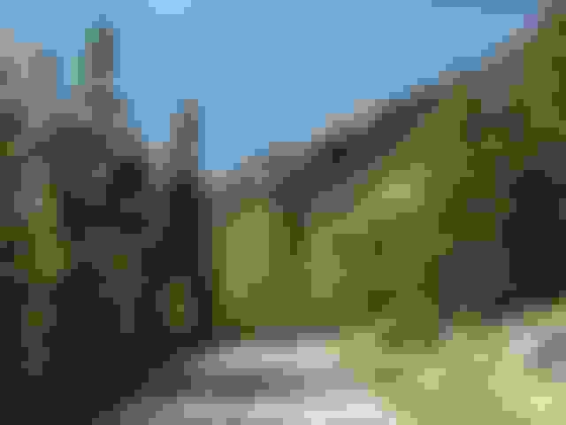
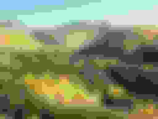
Here are a few pix from a couple years ago from Nacimiento-Fergusson Road approaching the coast. The last pix is from SR 1 near Big Sur. So worth the drive (and the wait for it to reopen).
This pix is taken from N-F Road. The road you see in the distance down by the water is Hwy 1, The Cabrillo Highway:
I've never actually been there to see them, but from what I understand, China has some of the craziest ones of them all. Some of the older passes across the Alps (which have since been superseded by tunnels) were more or less the same way.
None that's what I get for living in Florida, everything is flat here and straight roads But without a doubt, the one I want to drive and all the time I keep saying I'm going to go to, is the Tail of the Dragon
So, I made the drive on MO-76 yesterday! It was a long day - took about 3 hours to get from KC to the start of MO-39 south, which gets pretty twisty long before it meets up with 76. Then, there are about 40 minutes worth of up and down, back and forth highway. There were even a couple of hairpin turns, and many turns would have been unsafe to take at the posted 55-MPH speed limit. There's really good signage though, so nothing is a surprise. Also, sweet views of the hills from some of the high points. I drove very conservatively, since my fiancee was with me. I think she misunderstood what type of trip this was, as she really hated the twisty sections... But anyway, one of my buddies just got a Camaro SS - which handles "like you wouldn't believe" according to him. I'm thinking of proposing we do this trip again next year and do a chase through the turns. It's a pretty challenging road and seems like it would test many modern cars to the extent of their handling abilities if you drove it fast enough.
There are a lot of scenic and a few challenging mountain roads in Colorado . . .
The Old Fall River Road runs from near the entrance to Rocky Mountain National Park to 11,796 feet above sea level at Trail Ridge Pass. The road was built in 1920 and is almost all gravel, not always two lanes wide. It's steep, up to a 16% grade in places, with several narrow switchbacks to keep you alert. It is lightly traveled, as most people take the newer Trail Ridge Road up to the pass from the opposite direction. That one's paved, but doesn't offer the "wilderness experience" of its elder brother. Both roads are closed during winter months, so check the internet to determine if they're still open early or late in the year. Since your destination is well above the treeline, the landscape changes pretty dramatically, and often there's light snow on the ground in the spring or fall.
If you're in the area, crossing the Continental Divide on US 26 in the Bridger-Teton National Forest is an adventure. I got there in a late May blizzard - and the plow trucks were following ME because they thought I knew what I was doing. "Don't you see the Texas plates on my RX? . . . You really think I know anything about snow or mountains . . . either one?" I'm just following the GPS over into the Snake River valley and Jackson Hole beyond.
Following the Aspen trail from Durango up to Silverton, CO. You can take the tourist train, but the drive gives you the chance to stop and enjoy the view from an outstanding and lightly-traveled road.
Why am I the only one on this nice road? I'm headed south from Aspen over Independence Pass and there's no traffic . . . Evidently I missed the little "Pass Closed" sign back in town . . . the pass has 10 feet of snow in it, and now I'm in for a 100-mile detour back to Glenwood Springs and I-40. So much for two-lane America!
I have friends and business in Atlanta GA, so I find myself driving between Nashville/Atlanta 3, 4, 5 times a year. If you have the time, there are some seriously fun roads in North Georgia/SE TN/NW Alabama that you can use to bypass Chattanooga. About 2/3rds of it is nice, smooth, 2 lane, flat 55mph. If you need to make up time, you can easily drive 60-70mph, lots of room to pass. Since I usually have more time once I'm heading home from Atlanta, I usually take the scenic route.
On I75 north, you get off at the "Resca" exit, GA Route 136. Man that's a fun road, rural, slighly curvy, fast sweepers, you go over two big hills before you hit LaFayette GA. Take the bypass, get back on 136 west, Then you go up Lookout Mountain, steep grade, great views, a few switch backs. Then you pass Cloudland Canyon State Park, drop dead awesome views if you stop there, good hiking trails as well, good place to kill an afternoon hiking a few miles. Anyways, then you go down Lookout Mountain on 136, pretty damn steep, 3 or 4 switch backs, into Trenton GA. Interesting note, this part of GA is completely geographically isolated from the rest of GA, being on the far side of Lookout Mountain, I think rt 136 up Lookout Mountain is the only road you can take out of Trenton goes to GA, ie it doesn't lead to TN or AL.
Once you pass through Trenton, you stay on GA 136, and go up Sand Mountain, once again, several switchbacks. GA 136 turns into AL 71 once you cross the state line. This whole time you are on the plateau of Sand Mountain, its flat. AL 71 dead ends into AL 73, turn right. AL 73 eventually goes down Sand Mountain, and is one hell of a steep grade, it dead ends at a stop sign in TN at some rail-road tracks that run parallel to Lake Nikajack(aka the Tennessee River). I've seen a semi truck that lost its brakes at the base of the mountain, right where that stop sign is at, it ran the intersection and ran over the rail road tracks, got stuck about 3-4 feet from hitting the water. You can also turn off at AL 93, which is little more than a goat path going down Sand Mountain and into the valley. I've been that way before, its one hell of a road, maybe a top speed of 25-30mph, god help you if two dually trucks came in opposing directions, the road isn't wide enough.
Once you are in Tennessee, right along the TN river, you turn left onto TN 156, head towards the little town of South Pittsburg, once there you cross a bridge over the Tennessee River. At this point you can now turn right back to I24, or go left for more crazy roads. Turn left into downtown S Pittsburg, turn right on 2nd/TN 156, aka the side of the road facing a huge mountain. Then you go straight up again, several switchbacks, couple thousand feet in elevation to the Cumberland Plateau. Once the road levels out, its straight, narrow, and smooth for about 30 miles Very few cars on the road, double yellow line, hardly any side roads that cut in, almost zero driveways, you go through a state forrest. Speed limit is 55, I've driven 80, 90 mph+ on this stretch.
Then you get to Sewannee TN, notable for the University of the South and nothing else. Turn right on 41A and follow the road into Mont Eagle TN. To go the fun way, drive past I24 and take a quick left for the old road(US 41) down the mountain, its steep, twisty, well paved and a riot, the speed limit is 35-40mph, I dare you to try anything faster than 45. Once you are off the mountain, turn left on TN 50, back to I24, continue your boring drive back to Nashville for the next 70-80 miles or so.
This is the fun way to get from Atlanta to Nashville, or vice-verca, if you have an extra hour and a half, maybe 2 hours if you drive slow it is just a gloriously curvy and scenic route. The country through there is some of the best in the Eastern United States.
Some roads in western China are pretty good with barely any traffic although landslides are a constant danger in spring and summer. It's weird and nice to see endless mountain peaks without a single soul anywhere, in the world's most populous country. Pics below were taken at mountain passes at almost 5000 m on the eastern edge of the Tibetan plateau.
Some roads in western China are pretty good with barely any traffic although landslides are a constant danger in spring and summer. It's weird and nice to see endless mountain peaks without a single soul anywhere, in the world's most populous country. Pics below were taken at mountain passes at almost 5000 m on the eastern edge of the Tibetan plateau.
The road up China's Tianmen Mountain in Hunan (the image I posted earlier) is a real classic.
Closer to home, check this one out....U.S. 33 running NW/SE across Shenandoah Mountain on the West Virginia/ Virginia border. U.S. 33 also crosses other difficult ridges both farther east and west of the one......but this is probably the Grandaddy for the sheer number of curves combined with a steep grade. The summit is crossed at an elevation of 3540 ft.
Closer to home, check this one out....U.S. 33 running NW/SE across Shenandoah Mountain on the West Virginia/ Virginia border. U.S. 33 also crosses other difficult ridges both farther east and west of the one......but this is probably the Grandaddy for the sheer number of curves combined with a steep grade. The summit is crossed at an elevation of 3540 ft.
I've never been through there but that reminds me of Rt 60 in WV from I-64 to Rt 19 which is the old way to get to my hometown, although that's longer, about about 800 feet higher elevation.
That road was a lot of fun in my GS, not so much in the LS lol
I've never been through there but that reminds me of Rt 60 in WV from I-64 to Rt 19 which is the old way to get to my hometown, although that's longer, about about 800 feet higher elevation.
WV has a lot of roads like that, particularly in the Eastern half of the state where the terrain is much more rugged than in the west. Like you, I've been on some of them.......not all of them.
Still think, though, that the steepest grade I've seen, for runaway trucks (not the curviest, though, by any means), is the 3.5 mile 10% U.S. 40 descent down Chestnut Ridge into Uniontown, PA, a few miles north of the PA/WV border. It's killer-stretches like that which led to the development of the Jake Brake on large trucks.
That hill, BTW, is famous....arguably the most famous one East of Pikes' Peak. Many decades ago, Hill-Climb motorsports were held there, and auto companies tested engines, transmissions, cooling systems/radiators, brakes, and other components going up and down the long steep grade.

 06-07-17, 11:50 PM


 that's what I get for living in Florida, everything is flat here and straight roads
  But without a doubt, the one I want to drive and all the time I keep saying I'm going to go to, is the Tail of the Dragon